
Archive Record
Images
Metadata
Title |
Blueprints for Kendall Station and Norwich Railroad Station, and Routes 5 and 132 |
Object Name |
Map |
Catalog Number |
2018.8.1 |
Year Range from |
1923 |
Year Range to |
1962 |
Scope & Content |
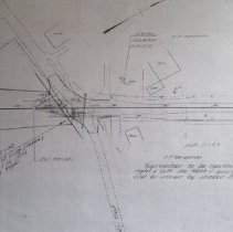
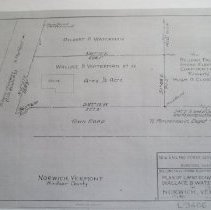
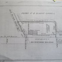
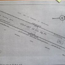
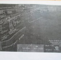
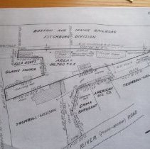
Six xeroxed maps, two of which show Kendall Station property and the surrounding area in Pompanoosuc (1959), two of which show the location of the Norwich Railroad Station and surrounding area in Lewiston (1923-1960), and two of which show the land owned by Delbert P. Waterman and his son Wallace Waterman as land was conveyed to the New England Power Service Corporation (1945) and later as roads were reconfigured around Route 5 North, Route 132, and Old Bridge Road (date uncertain). All of the original maps are in the Town Clerk's Office. |
People |
Gleason Family Lewis Family Sargent, Emma Thompson family Thompson, J.D. Trumbull Family Waterman, Delbert P. Waterman, Wallace Goodell, Perry F. |
Subjects |
Houses Railroads Rivers Roads and Highways Stores Town History |
Search Terms |
American Oil Company Boston and Maine Railroad Dartmouth College Lewiston Pompanoosuc Route 132, Norwich Route 5 Trumbull-Nelson |
Credit line |
Gift of Nancy Osgood (copies courtesy of the Norwich Town Clerk's Office) |